


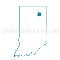
CLEVELAND SOUTH, Whitley County, Indiana
About
Outline

Summary
| Unique Area Identifier | 581298 |
| Name | CLEVELAND SOUTH |
| County | Whitley County |
| State | Indiana |
| Area (square miles) | 30.47 |
| Land Area (square miles) | 30.47 |
| Water Area (square miles) | 0.00 |
| % of Land Area | 99.99 |
| % of Water Area | 0.01 |
| Latitude of the Internal Point | 41.04266160 |
| Longtitude of the Internal Point | -85.62900110 |
Maps


Graphs
Select a template below for downloading or customizing gragh for CLEVELAND SOUTH, Whitley County, Indiana


Neighbors
Neighoring Voting District (by Name) Neighboring Voting District on the Map
- CHESTER 02, Wabash County, IN
- CLEAR CREEK TOWNSHIP, Huntington County, IN
- CLEVELAND NORTHEAST, Whitley County, IN
- CLEVELAND NORTHWEST, Whitley County, IN
- JACKSON 2, Kosciusko County, IN
- WARREN TOWNSHIP, Huntington County, IN
- WASHINGTON NORTH, Whitley County, IN
- WASHINGTON SOUTH, Whitley County, IN
Top 10 Neighboring County Subdivision (by Population) Neighboring County Subdivision on the Map
- Chester township, Wabash County, IN (8,009)
- Cleveland township, Whitley County, IN (3,398)
- Clear Creek township, Huntington County, IN (1,928)
- Washington township, Whitley County, IN (1,281)
- Jackson township, Kosciusko County, IN (1,238)
- Warren township, Huntington County, IN (672)
Top 10 Neighboring Place (by Population) Neighboring Place on the Map
Top 10 Neighboring Unified School District (by Population) Neighboring Unified School District on the Map
- Huntington County Community School Corporation, IN (37,124)
- Whitley County Consolidated Schools, IN (22,836)
- Whitko Community School Corporation, IN (10,537)
- Manchester Community Schools, IN (10,421)
Top 10 Neighboring State Legislative District Lower Chamber (by Population) Neighboring State Legislative District Lower Chamber on the Map
Top 10 Neighboring State Legislative District Upper Chamber (by Population) Neighboring State Legislative District Upper Chamber on the Map
Top 10 Neighboring 111th Congressional District (by Population) Neighboring 111th Congressional District on the Map
Top 10 Neighboring Census Tract (by Population) Neighboring Census Tract on the Map
- Census Tract 503, Whitley County, IN (5,303)
- Census Tract 9613, Huntington County, IN (4,625)
- Census Tract 1023, Wabash County, IN (4,309)
- Census Tract 507, Whitley County, IN (3,404)
- Census Tract 9626, Kosciusko County, IN (2,729)